Your cart is currently empty!
Posted in
Memorial Day Trexpedition through the Sierra Ancha Mountains in Arizona.
Dusk was approaching as we gathered at the gas station off Highway 87 just outside of town. After a lengthy introduction and a short chit-chat, we tuned our radios to the frequency with desired. As we hit the highway towards Punkin Patch, the sun was quickly setting.
The plan for the night was to travel a short distance to the DuPont cabin just east of Punkin Patch. The trail was easygoing and fast-paced at first. After veering off to a side trail, it got a little more interesting. Loose baseball-sized rocks made traction nearly impossible as we ascend a long steep shelf road towards Dupont cabin. One rock shelf and two switchbacks required careful navigation with little room and no visibility.
Around 11 o’clock, we finally reach the Dupont cabin and unite with the rest of our group. The fire was lit, and the conversation was going as we each set up our camp. Greetings and introduction for a second time were delightful. It’s always a good time to see old friends and make some new ones.
Day two
Dawn was approaching, and nature was calling. Stepping into the bush was relieving in many ways if you know what I mean. I started my morning with a walk around Dupont Cabin. It was in a significant state of decay and was built strong. The place could use some structural reinforcement.
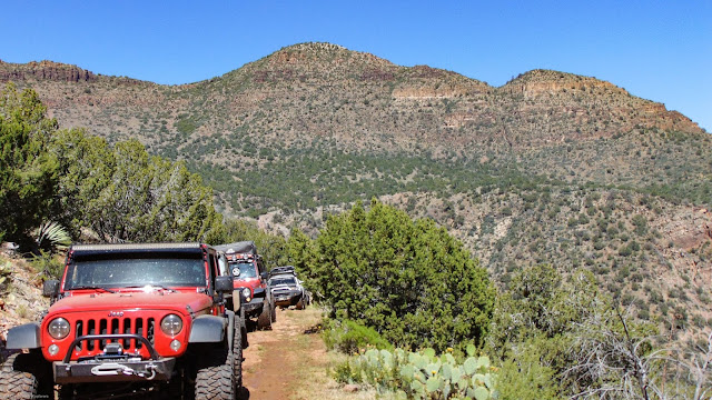
The Dupont mine
Dupont Mine was just a little ways from the cabin. It was established in the 1930s, and according to the record, Copper was the primary mineral they were after. However, all other claims in the surrounding area were for uranium.
Dupont was an industrial giant who, at the time, was involved in the top-secret Manhattan Project. His team designed the first nuclear reactor and eventually the first machine to refine uranium to produce nuclear weapons. Is it possible Dupont was secretly extracting uranium from the Copper Mountain Mine? Only further research would tell.
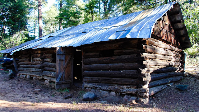

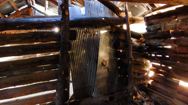
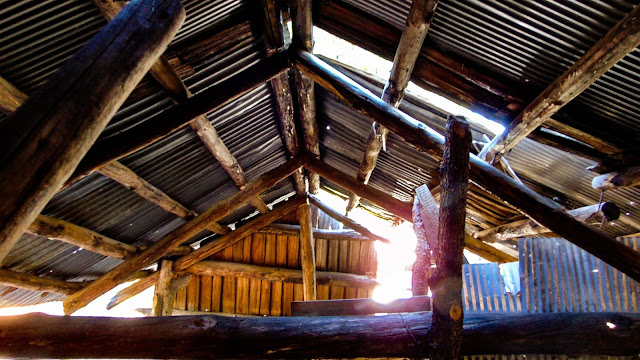
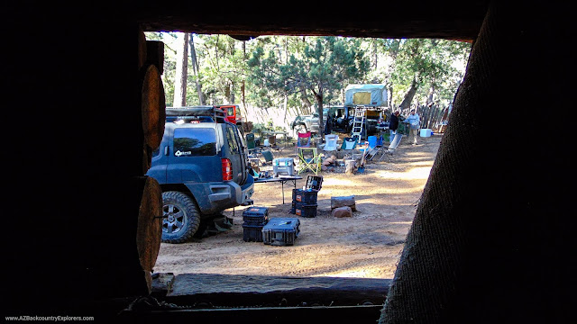
We packed up camp and started to head north across Buckaroo Flats. Our plan for the day was to start the Cheery Creek trail and camp somewhere along the way. As always, the Sierra Ancha mountains are an incredible experience. Although there was no water, the weather was beautiful.
Our entire group needed fuel, so we decided to beeline down the Desert to Tall Pines scenic road towards Young. Our group quickly took over the two-pump gas station. Locals waited patiently as we stimulated the local economy. After acquiring fuel, food, ice, and water, we were set for day two.
Continuing forward, Cherry Creek comes into view. This particular section is part of our Sierra Ancha Mountains Loop 4×4 Trail. The last time we were here, it was phenomenal. The trees were changing color, and each tributary was flowing water. This time was a little different due to the season.
To the east, P B Ranch sits just off the trail. There is an old cabin built in the 1930s. The original cabin is on the opposite side of the meadow and was built in the late 1800s. The newer cabin is in excellent condition.


Winding up, over, and around Cherry Creek is an easy trail with a few moderate stretches. In particular, the washout at the Gold Creek tributary is sketchy. It’s nothing an experienced off-road driver can’t handle.
A bypass has been created. The sharp left turn drops you into Gold Creek, where another quick left turn brings you out. Coming out requires proper tire placement. Cut your rear tires short, and you’ll end up off the cliff.
One of our group members did just that. Before rolling, he decided to call for help. Although it was his first time on the trail, he did a great job the entire weekend. A few of us gathered together, staked rocks, and helped him place his tires in the right spot.
We proceeded towards Roosevelt Lake, where we would take state route 288 back towards Young. We eventually found a campsite along Little Walnut Canyon just a few miles outside of town. After preparing a delicious dinner, it was finally time to call it a night.


Day three
When morning came, we all decided to end the trip and start for home. We took our time at camp, cooking breakfast, and making conversation. Eventually, everyone parted ways. I choose to take a long way home and continued down the Desert to Tall Pines scenic road. Soon reaching Roosevelt, I connected with Apache Trail to make my way home. The traffic was insane on state highway 88.
Just days later, a devastating wildfire burned over 120,000 acres of pristine wilderness along my route. The human-caused Woodbury fire burned the entire Superstition wilderness, and then some. I’m grateful for one more chance to witness the beauty Apache Trail has always offered.https://www.youtube.com/embed/BpYOWXDx3_w
I had a great time on the trail this weekend. We made our way through the Sierra Ancha mountains up to Young. The next…
Posted by Arizona Backcountry Explorers on Monday, May 27, 2019
Trexpedition part 3
Posted by Brandon Edmundson on Sunday, May 26, 2019
We had a great weekend with some members of Overland AZ, Arizona Trek, and Arizona Backcountry Explorers. We met up…
Posted by Overland_AZ on Monday, May 27, 2019
What an incredible weekend…the group, the views, the technical trails and the trails, ….so good, we had to do them…
Posted by Frank Galainena on Monday, May 27, 2019
Tags:
You may also like…

Visit the AZBackroads.com Store
Please Become A Member
We need your help to keep our backroads open. Please join today!

