Your cart is currently empty!
Posted in
We attendedd our second meeting concerning the Apache Trail with Senator Kelly Townsend and County Supervisor Jeff Serdy at the Pinal County Board of supervisors’ office. It was another productive meet with high hopes for the future of Apache Trail.
Senator Kelly Townsend “what do you want?”
Republican Senator Kelly Townsend from district 16 attended the meeting in person and is dedicated to reopening the road. She is introducing legislation to compel the Arizona Department of Transportation to act. She took notes with a pen in hand while expressing her concern over the process. “What do you want?” she asked the entire room of businesswomen and county representatives.
I expressed concern overall on 22 state highways that fall under the same “low volume” category as Apache Trail. I argued that the same issues could arise on other highways included in the 2017 Low Volume State Route Study, such as highways 288 and 191 that provide access to entire towns. We believe ADOT should be forced to withdrawal those standards from any internal policy or management decisions.
We also suggested creating a special road district and a custom Arizona license plate to help fund future maintenance on Apache Trail; prohibiting ADOT from applying low-volume standards to state highways; creating ADOT maintenance standards for dirt roads; a collective effort by surrounding counties to fund maintenance,
SHPO is waiting on ADOT to make a decision.
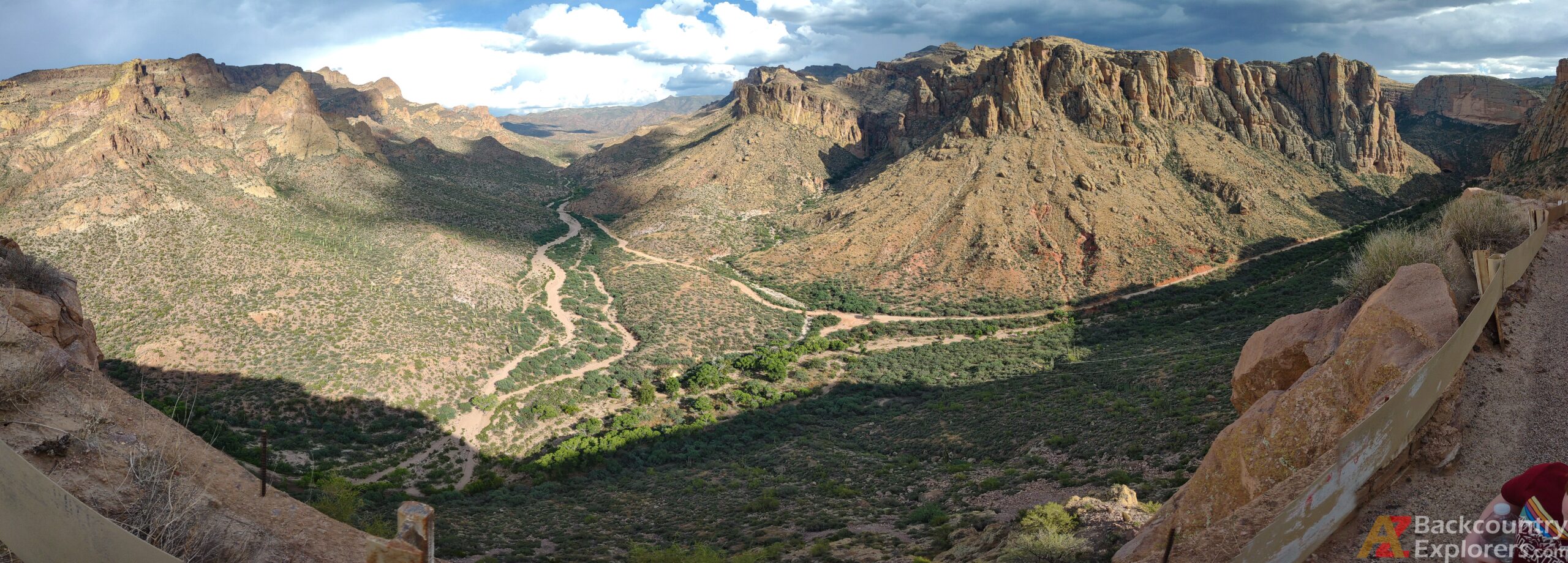
The State Historic Preservation Office claims that Fish Creek Hill is eligible for registration in the National Register of Historic Places. Therefore it is governed by the National Preservation Act. However, it is not on the register, and SHPO is not a regulatory body. They consult state and federal agencies on how to preserve the historical aspect of nationally registered or eligible historic places. They also list sites on the National Register of Historic Places and assist private individuals with restoration projects.
We spoke with archeologist and preservationist Bill Collins from the Arizona State Historic Preservation Office for nearly two and a half hours on the phone and learned a lot about the ordeal. Bill has been leading the charge for preserving Fish Creek Hill and other aspects of the Apache Trail for nearly three decades. Bill is one of the most intelligent people I’ve ever interacted with, and while we had many disagreements, we agreed on the key points. He articulated many different matters, and we will consult with him on other issues moving forward.
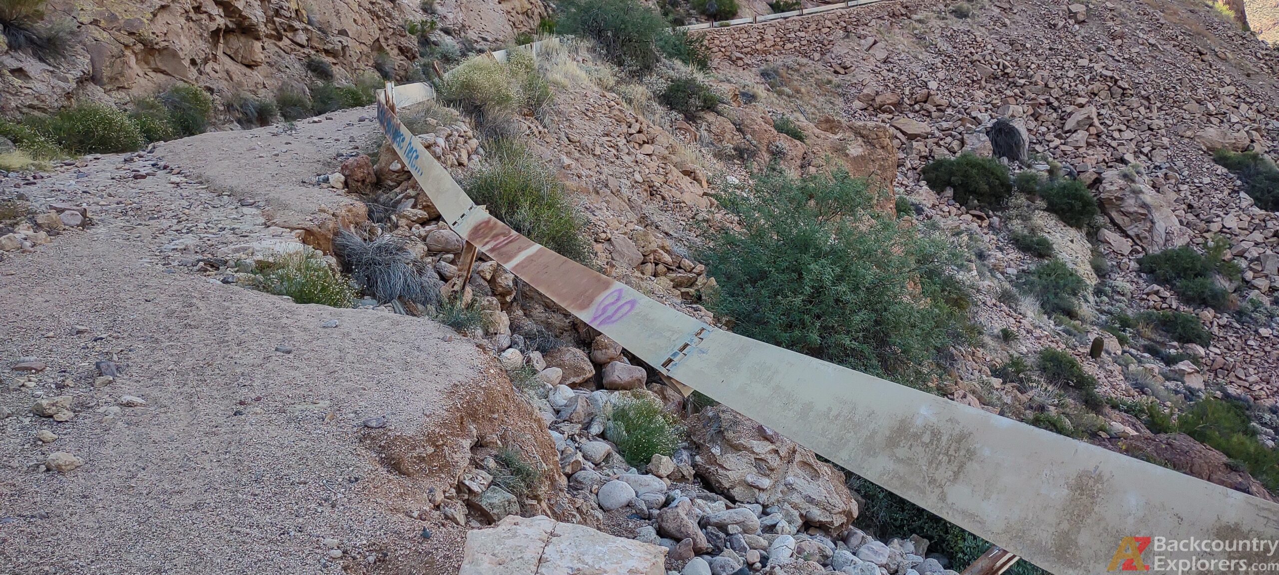
SHPO is in disagreement because the historical aspect of the road is ruined, and like us, they are also concerned about ADOT’s new standards for the road. They agree that it’s impossible to apply these standards while preserving what’s left of the historical construction.
SHPO is currently waiting on ADOT to make a decision on the Apache Trail and gave us great suggestions on how to move forward. He suggested involving the Apache Indian tribe and recommended pursuing a solution in favor of access. He suggested a width limit be put on Apache Trail prohibiting large vehicles from traveling the Fish Creek section of the road and argues the road isn’t suitable for large vehicles and prefers non-motorized traffic.
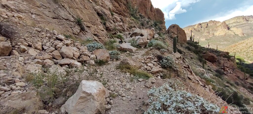
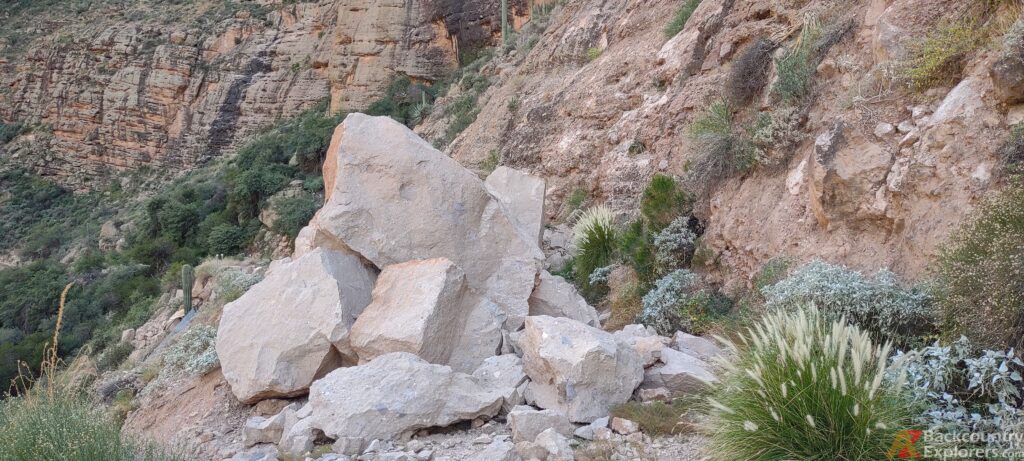
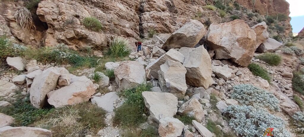
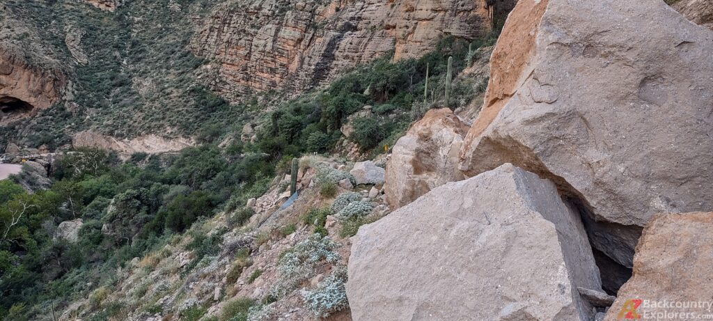

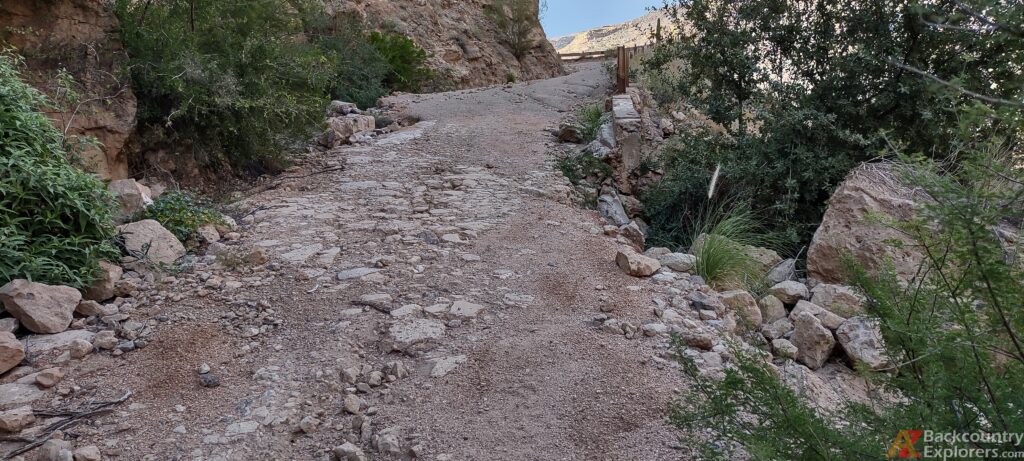
ADOT video makes false claims that fire damaged Fish Creek Hill.
ADOT released this video to explain the current condition of the Apache Trail, and it appears they are changing their tune and giving the public something of substance. However, they are still falsely asserting the Woodbury Fire caused the damage to Fish Creek Hill.
In the video, ADOT acknowledges the $700,000 approved by the Arizona Legislature to begin the studies needed to repair the road. They cite a US Forest Service Burn Area Emergency Response team that claims the burn scare from the Woodbury Fire will take 3-5 years to recover to pre-fire conditions and imply that repairs to Apache Trail are on hold due to the risk of continued rockfalls and severe flooding.
In the video, ADOT asserts the US Forest Service owns the road despite the unrefutable fact that the US Congress quitclaimed the land to Arizona. As shown in the last article, there is a deed to Apache Trail in the Maricopa County Recorders office. For some reason, this doesn’t matter to ADOT, the US Forest Service, or others who are responsible for the road.
In this video, you will notice ADOT never shows the spot from where the rock fell. However, the large boulder is visible in the historic photo shown at the beginning of the video. You can also see the boulder on Google street view and historical aerial photographs. Although the boulder was teetering above the road for decades, ADOT previously expressed obvious concern that it would fall. Instead of removing the boulder, they glued it in place many years ago in a failed attempt to prevent the boulder from falling.
You’ll also notice the script in the assistant’s hand complemented by closely chosen words by the narrator and somewhat settle fear-mongering with the pan of a camera. They show the thrilling roadside cliff while mentioning safety hazards as if Apache Trail travelers should be worried.
All the while, the Tonto National National Forest describes the Apace Trail as follows.
“The scenic byway (with numerous sharp curves and narrow stretches of road) is safe to all but the reckless driver. Traffic is moderately heavy on weekends, less on weekdays. Pulling trailers of any type over this road is strongly discouraged. A significant part of the byway is unpaved, and is normally suitable for passenger cars. Keep to the right. DRIVE CAREFULLY AT ALL TIMES. At Fish Creek Hill (Milepost 222.5), the road is primarily one-way (with turnouts), climaxing in a 1,000-foot drop in elevation over a 15-17 percent grade, hugging the bronze bluffs. For closer viewing and photo-taking, please stop at the vista points where there is safe parking. DON’T look while driving! The road is safe but one must pay close attention to twists, blind-turns, and oncoming vehicles. Prepare yourself for a most unusual experience: some of the most spectacular scenery to be seen in all of the West.“
SR 88/Apache Trail Closure Update from ADOT Vimeo-External on Vimeo.
Conclusion
With ADOT wanting to completely re-engineer the road to make improvements, there are conflicting interests between ADOT and the State Historic Preservation Office. ADOT is attempting to destroy the historical aspect of the road with new, unrealistic standards that can’t be applied to Fish Creek Hill. ADOT can’t improve the road without going against what the State Historic Preservation Office says. Until ADOT comes up with a resolution to reopen the road that preserves the historical qualities, SHPO will likely disagree with any solution put forward.
One of the things we are asking the Governor, ADOT, and the Arizona Transportation Board to do is start the studies approved by the legislature. The legislature didn’t only give ADOT money; they compelled them to complete the studies. As mentioned in the video above, this is ADOTs next step, and they are stalling because of the determination made by the US Forest Service BAER team after the Woodbury Fire.
ADOT has been trying to get rid of Apache Trail for many years. Consistently claiming the road belongs to the Tonto National Forest contrary to an act of Congress. It looks like the rockfall is just what they needed to justify the abandonment of the most iconic road in the Western United States.
Please send our letter to the Arizona Governor and ADOT
Tell the Arizona Department of Transportation and the Arizona Governor to reopen Apache Trail
Tags:
You may also like…

Visit the AZBackroads.com Store
Please Become A Member
We need your help to keep our backroads open. Please join today!
