As many of you may know, we have made an effort to pressure the Arizona Department of Transportation and Arizona Governor Doug Ducey to reopen Apache Trail State Route 88. We are happy to inform you that we are making headway.
ADOT calls a meeting with interested parties
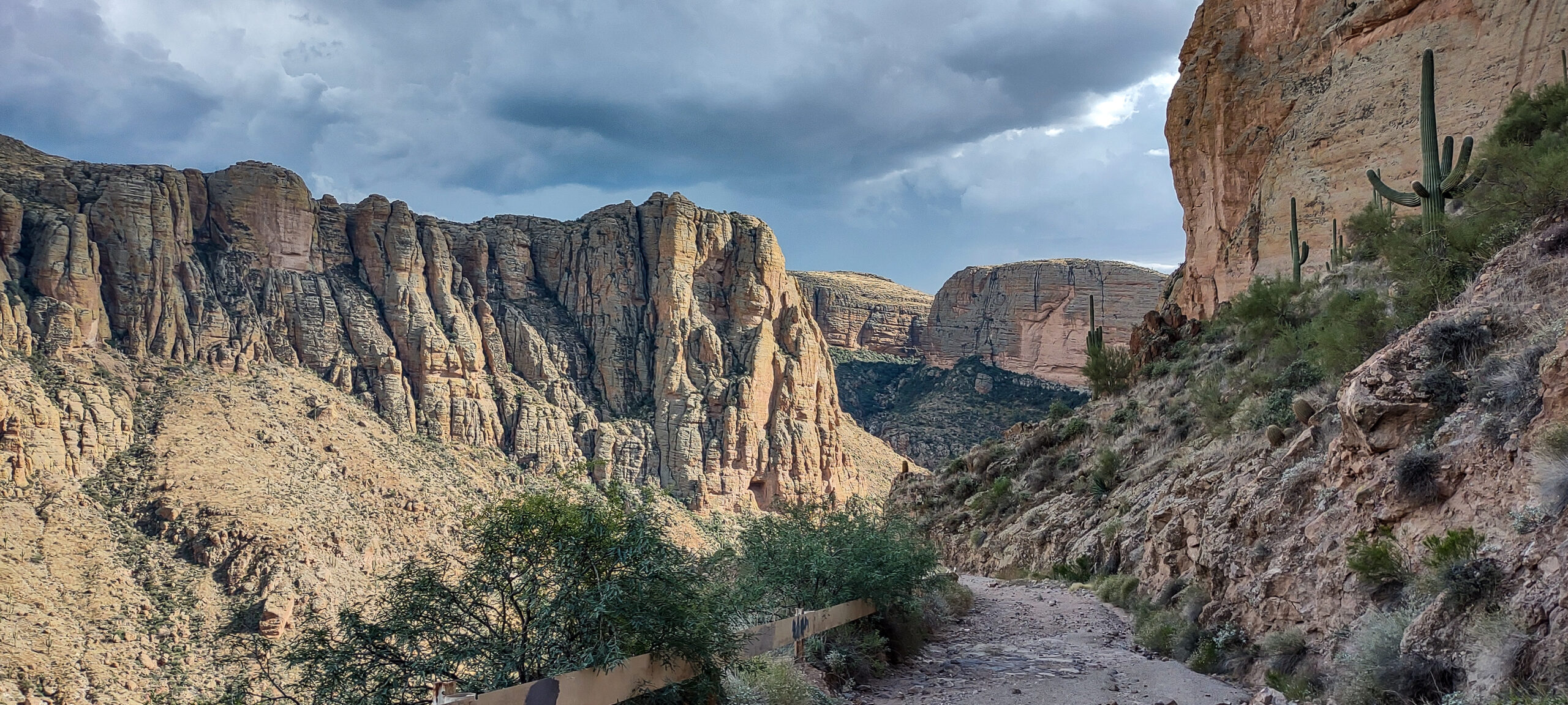
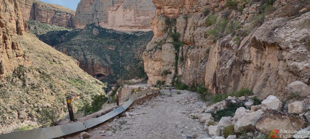
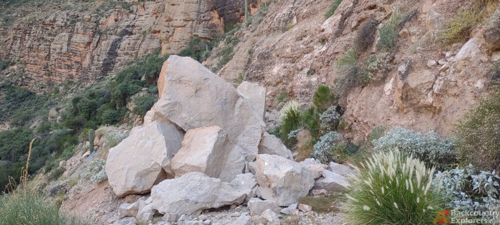
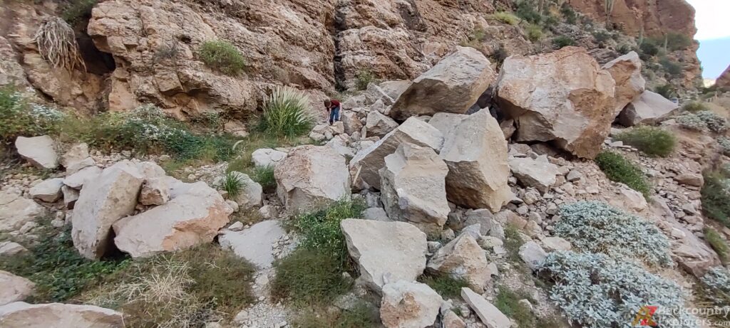
ADOT has called a meeting with several local elected officials to discuss the future plans for Apache Trail. ADOT was going to unlock the gate and escort our elected officials down the road to see the damage. ADOT called off the meeting at the last minute and decided to send an engineer to assess if the 1.5-mile hike to the Rock Fall would be “safe.” As expected, ADOT determined that the road was not.
Now ADOT plans to take drone footage to present to interested lawmakers and elected officials. We have been invited to attend the meeting with local business owners who this closure has impacted. We will be live streaming the video on our Facebook Page, and the Video will be found on the Apache Trail Page on our website. There is no date set.


ADOTs Email
If you sent our letter to ADOT, you might have received an email directly addressed to you promising to keep us informed on any further updates concerning the Apache Trail. ADOT doesn’t reveal any new information in the letter and still doesn’t commit to reopening the road. However, They have created a page on their website dedicated to Apache Trail information. They also agreed to keep the public updated via social media and email.
Dear Arizona Backcountry Explorer users,
Thank you for reaching out to the Arizona Department of Transportation (ADOT) about State Route 88 (Apache Trail). ADOT recognizes and appreciates the historic significance and natural beauty of the Apache Trail and the desire for backcountry users to explore the area.
Unfortunately, the 7-mile segment of SR 88 between milepost 222 and 229 remains closed for public safety reasons, due to extensive roadway damage and rock debris. As you are aware, a large storm passed through the area and the runoff from the Woodbury fire burn scar caused this damage and is considered an ongoing risk with future storms.
ADOT, in cooperation with the U.S. Forest Service and Arizona Game and Fish, is allowing UTVs, equestrians, hikers, and bicyclists to access public lands via SR 88 on the Apache Lake closure side to access the Reavis Ranch Trailhead. ADOT is not allowing access on the south side due to the extensive damage to the road.
As you may be aware, the state legislature has appropriated funding for an SR 88 study to evaluate revegetation in the Woodbury burn scar area and what options are feasible from a long-term construction and maintenance cost perspective on restoring access to Apache Trail and the Tonto National Forest area.
It is important to note that while ADOT has a highway easement for SR 88, the underlying landowner is the US Forest Service. ADOT, in conjunction with the US Forest Service, namely the Tonto National Forest, will continue to put public safety first in consideration of allowable uses on the closed portion of SR 88.
We will keep the Arizona Backcountry Explorer users and other interested members of the public informed of progress of the SR 88 study, roadway repairs and improvement projects through email and social media, and will post the study documents when they are completed.
We have added anyone who has reached out to us about this issue to our SR 88/Apache Trail email list. Others who are interested can sign up for the email list at azdot.gov and select Subscribe for Updates at the top of the page.
For more information, please visit the SR 88/Apache Trail ADOT webpage.
Thank you,
Arizona Department of Transportation
Please become a supporting member.
For just 30 cents a day, you can help us keep trails open!
Gain access to our GPS tracks plus an incredible collection of 1,300 Points Of Interest to explore around the state. You will also get access to commentary from the author.
Our responce
ADOT asked us to share additional email addresses in a separate email and claimed they only received 500 emails. They want the remaining 350 email addresses to add to their Apache Trail list. We respectfully declined as our privacy policy does not allow us to share collected emails with anyone. However, we agreed to reach out to those who opted into email updates on our system and ask them to sign up.
In response to ADOT, we took the opportunity to express our concern in detail, breaking down the importance of the RS 2477 right-of-way that was forfeited by the federal government and the Arizona law that requires compliance with certain procedures.
We are moving foward
The response from ADOT has been slow, but advancements are being made. We are delighted that ADOT is taking steps to keep the Arizona People updated per our request, but it’s not enough. ADOTs response to our request is generic and is the same old story we have been hearing for two years. It doesn’t address our concern about the rockfall on Fish Creek Hill and the attempt to forfeit the Right-Of-Way that falls under the provisions of Revised Statute 2477. We believe it’s an attempt to appease us.
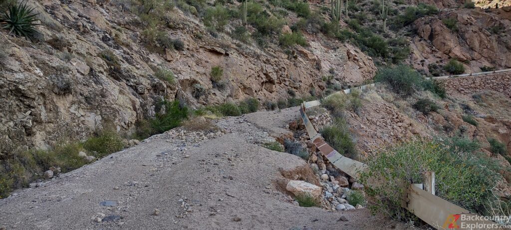
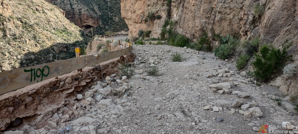
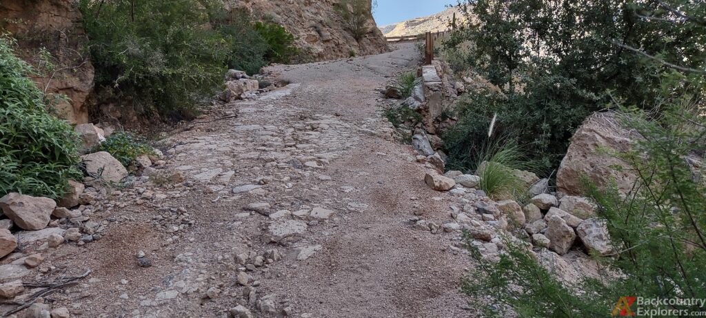
In the past few weeks, we have met with local business owners who contract in commerce along the Apache Trail and have engaged in the process since the Woodbury Fire. We discussed what has been done so far, and we provided some insight into moving forward. We learned some very important details about the process in the past 2 years during this meeting. We intended to prepare a detailed presentation to convince local lawmakers to reopen the road.
Shortly after, we assembled a second meeting with local congressional, state, and Pinal County political representatives and representatives from the Tonto Nation Forest and local historical societies. We were prepared to convince the entire room that the road needed to be reopened but quickly learned everyone was on our side. Pinal County officials recognize the importance of Apache Trial to the small communities in the vicinity and notate that a significant economic impact has occurred due to the closure.
District Ranger Matthew Lane from the Tonto National Forest represented the surviant estate and basically had no bone to pick in the fight. He claimed that the Forest Service doesn’t have the money to fix the road, and if they took it over, it would be permanently closed and designated as a hiking trail. He expressed no desire of the National Forests to acquire Apache Trail. I took the opportunity to apologize for being so harsh to the Tonto National Forest, and Matthew Lane accepted our apology.
Thus far, our think tank has acquired more insight into the challenges facing the future existence of the Apache Trail. Although we can’t talk about many of the details to prevent interference, several people are doing their part to pinpoint exactly why the road isn’t fixed and work around those challenges. So far, the Arizona Department of Transportation is telling us all the same old story and leaving out important details.
Apache Trail State Route 88 is an RS 2477 Right-Of-Way
The history of the Apache Trail is well documented. It is well known that the construction of the Apache Trail was completed in late 1905. It wasn’t until 1907 when then US President Theodore Roosevelt signed the Tonto Declaration withdrawing the Tonto National Forest from public entry.
To solidify the State of Arizona’s rights to the Apache Trail, the US Congress passed a law in 1954 quitclaiming all rights to the road except mineral rights to the state of Arizona. The law reads as follows:
Be it enacted by the Senate and House of Representatives of the United States of America in Congress assembled, That, subject to the reservations set out in section 4 of this Act, the United States of America hereby quitclaims all of its right, title, and interest in and to the land described in that certain deed executed by Salt River Valley Water Users’ Association, an Arizona corporation, dated May 20, 1941, and recorded May 20, 1941, in the office of the county recorder, Maricopa County, State of Arizona, in book 360 of deeds at page 81, to the persons named as grantees therein or to the persons who succeeded to and now hold the possessory interests conveyed by said deed; and in addition thereto, the United States of America hereby quitclaims to the State of Arizona all its right, title, and interest in and to all that portion of the land lying within the right-of-way of the State highway designated on the plat of Victory Tract as the Apache Trail, said plat being recorded in the office of the county recorder of Maricopa County in book 31 of maps, page 6 thereof.
Office of the Federal Register, National Archives and Records Administration. “68 Stat. 969 – An Act to authorize the United States of America to quitclaim all its right, title, and interest in and to certain lands in Arizona, except for mineral interests therein, and for other purposes”. Government. U.S. Government Printing Office, December 1, 1954. https://www.govinfo.gov/app/details/STATUTE-68/STATUTE-68-Pg969-2
What we are asking
It appears that ADOT has simply stalled on this project and is not moving forward. Since the $700,000 was approved by the Arizona Legislature, ADOT has done nothing, and nobody is sure why. ADOTs response to this issue has frustrated everyone, and we are pressing for answers.
We intend to force ADOT to start the required process to, at a minimum, get the road reopened at a minimum maintenance level as suggested in the 2017 Low Volume State Route Study and maintain the road as dirt until the surrounding area can recover from the Woodbury Wildfire burn scar. We need ADOT to start the studies and get the ball rolling.
Luckily, with the help of several local political representatives, we have high hopes that we will successfully reopen the world-famous Apache Trail. We are fortunate enough to have assembled a team of dedicated leaders who truly work on behalf of their constituents.
Please consider helping us out along this process and become an Expeditionist Member. We could use your help paying for fuel, records requests, and other expenses during this time.
