Your cart is empty
The Tonto National Forest just released the Draft Record of Decision for the Tonto National Forest Land Management Plan. This plan will completely change how the Tonto National Forest is managed for the next 10-15 years. The notice was published in the Federal Register on March 25th, 2022 marking the beginning of the 60 day objection period on over 3,000 pages of documents.
We previously wrote about this process stressing some of the proposed changes and guidelines for the Tonto National Forest including over 50 Wilderness and 20 Wild and Scenic River recommendations as well as multiple Botanical and Study Areas.
The new forest plan breaks down the management of the National Forest into several categories and lays out the Desired Conditions, Objectives, Standards, and Guidelines of each category. The categories cover topics ranging from relationships with volunteers and partnerships to the way dispersed recreation and other forms of multiple-use are managed.
Roads
A large portion of this new plan addresses roads and dispersed recreation. The word “road” is mentioned nearly 160 times in the final decision and the word “motorized” is mentioned an additional 80 times.
Road closures and restrictions
The plan prioritizes the permanent closure of forest roads that impact flow regimes, are redundant routes, cause mass movement of soils and sediment, are built within a riparian management zone or have negative impacts on at-risk species. It sets a goal to decommission 100-600 miles of the 1,860 miles of roads identified by the travel management process over the next 10 years.
The plan prioritizes decommissioning motorized trails deemed unsustainable that have low use, no remarkable destination value, and/or are duplicate trails to the same destination, to improve environmental resource conditions and reduce negative impacts on ecological natural resources.
Inventoried Roadless, Botanical, and Research Management Areas
Inventoried Roadless Areas and study areas are protected management areas that are established by administrative procedure rather than congressional action. Roadless area characteristics are defined in the 2001 Roadless Rule as:
(1) High quality or undisturbed soil, water, and air;
(2) Sources of public drinking water;
(3) Diversity of plant and animal communities;
(4) Habitat for threatened, endangered, proposed, candidate, and at-risk species and for those species dependent on large, undisturbed areas of land;
(5) Primitive, semiprimitive non-motorized, and semiprimitive motorized classes of dispersed recreation;
(6) Reference landscapes;
(7) Natural appearing landscapes with high scenic quality;
(8) Traditional cultural properties and sacred sites; and
(9) Other locally identified unique characteristics (36 CFR 294.11)
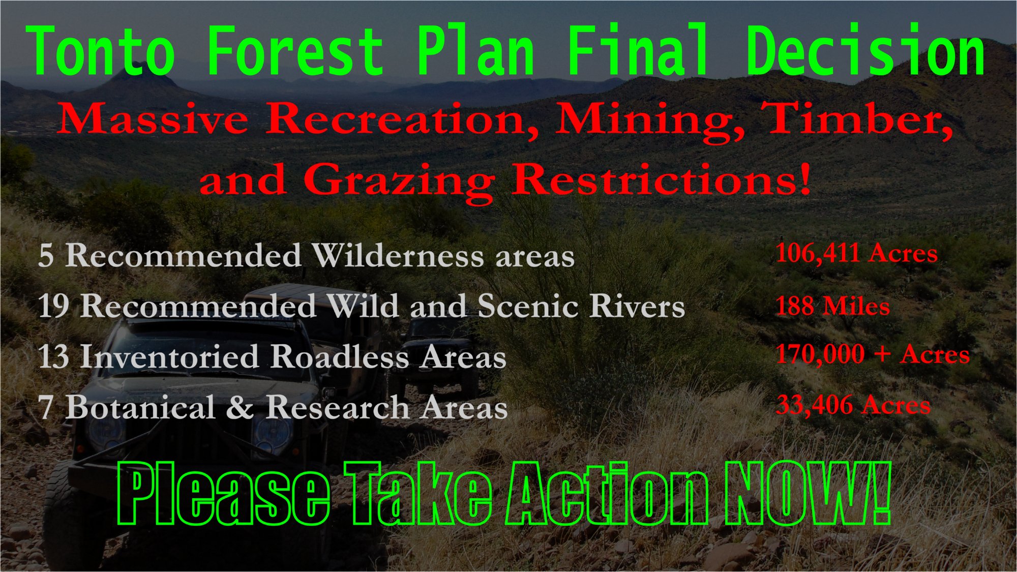
Thirteen Inventoried Roadless Areas containing 170,100 acres of public land in the Tonto National Forest are identified in the management plan. The rules prohibit timber harvesting, road construction, and reconstruction within the thirteen roadless areas. Each roadless area will be managed for primitive non-motorized and motorized recreation opportunity spectrum.
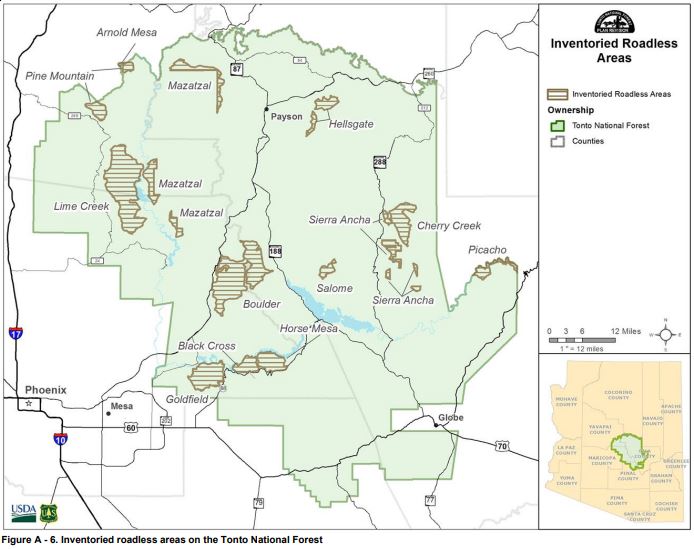
The Tonto National Forest currently has 3 Botanical and Natural Research areas. This plan will add 7 Botanical and Research areas restricting a total of 33,406 acres of public lands in the Tonto National Forest from various multiple uses.
The plan will prohibit overnight camping, campfires, timber sales, fuelwood gathering, mining, and livestock grazing within each Botanical and Natural Research Area.
Developed and Dispersed Recreation
This section of the Tonto National Forest Plan describes the management of several developed and primitive recreation sites and activities including motorized use of forest roads, camping, hiking, and so on. The plan objectives set a 10-year timeframe to accomplish the following goals:
- Reestablish the natural landscape in 5 to 7 areas where dispersed recreation is causing erosion.
- Implement at least 3 strategies to discourage illegal dumping, and driving on closed roads. (In other sections of the plan hard closure and permit systems are suggested.)
- Develop or modify groups of sustainable motorized trail systems that are interconnected, with defined access points, and similar recreation destination values.
In addition, the Tonto National Forest will “take appropriate action” every 5 years to close or decommission at least 10 miles of currently designated motorized or non-motorized trails that may not have recreation value. This includes low-use trails and trails that have no remarkable destination value.
Permit and reservation systems will be considered to reduce visitor conflicts in popular wilderness areas, target shooting areas, and OHV areas across the Tonto National Forest. The Forest Service will also consider the additional fee areas to maintain and manage developed recreation sites.
Developed Recreation
The Forest Service will also consider decommissioning developed campgrounds and recreation sites that are low use or have no remarkable destination value. While evaluating to operate or close a site, the Forest Service will consider the volume of use and public demand, resource protection, opportunities for public-private partnerships, equitable geographic distribution, and operating cost.
Dispersed Recreation
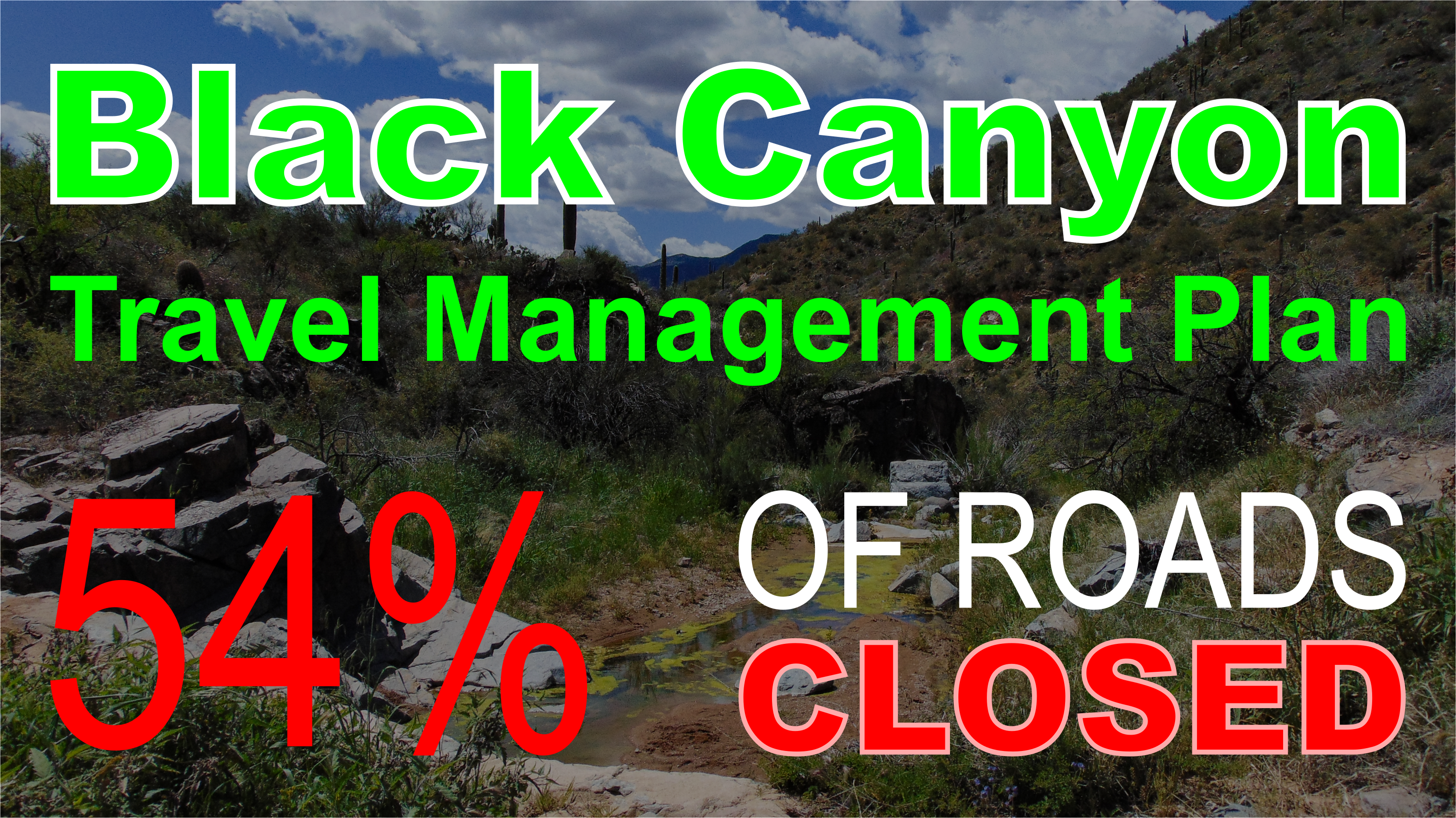
I previously wrote about the Tonto National Forest Travel Management Plan and highlighted the direct prohibition on dispersed camping along Forest Roads in the Tonto National Forest. The Travel Management Plan limits dispersed camping to 2,864 designated dispersed campsites in the entire Tonto Forest. Additionally, these sites will not be open to the public until they evaluate every campsite for the environmental impact caused by recreation use.
The new Forest Plan suggests that dispersed recreation sites should be closed if preventive and routine maintenance is unsustainable, persistent user conflicts, damage to natural resources from recreation, and conflicts with other resources like riparian areas. The forest service will develop a forest-wide protocol to assess the sustainability, objectives, and use of national forest system trails and dispersed campsites, address resource damage and user conflict by utilizing closure orders.
Become a Member and get access to members-only content!
Get access to:
- Over 400 GPS Tracks of the greatest 4×4 adventures in Arizona.
- Over 1,300 waypoints of the most incredible destinations for your GPS device.
- 10% discount on all merch in our store.
- Commentary from the author.
Wilderness and Wild and Scenic Rivers.
Wilderness Areas
There are currently eight designated wilderness areas within the Tonto National Forest. Included in this plan are an additional five recommended wilderness areas covering a total of 106,411 acres of public land. There are also several additions to the Sierra Anch Wilderness that expands the wilderness area to the edge of Cherry Creek Road.
Each recommended wilderness area will be managed to protect the wilderness characteristics until they are considered for designation by Congressional action. Energy development, mineral extraction will be prohibited mechanized use will be limited. Motorized use will be prohibited inside these areas except for the retrieval of big game and other authorized uses.
Wild and Scenic Rivers
The Tonto National Forest currently has two wild and scenic rivers. This plan will recommend an additional 19 Wild and Scenic River designations totaling 188 miles. Each river segment will be managed to preserve the Wild and Scenic qualities until Congress can act on the designation. There are a total of 66 miles classified as wild, 83 miles as scenic, and 40 miles as recreation.
Each segment will be managed consistent with the Recreation Opportunity Spectrum of primitive to semiprimitive nonmotorized in eligible wild rivers; semiprimitive nonmotorized to semiprimitive motorized in eligible scenic rivers; semiprimitive motorized to roaded natural in eligible recreational rivers.
Like Wilderness areas, Wild and Scenic Rivers must be designated by an act of Congress. These designations are split into 3 categories: wild, scenic, and recreation based on the free-flowing condition and surrounding development. Activities in the identified river segments shall comply with protective measures in Forest Service Handbook 1909.12, 84.3, or the current version.
Fish Creek Wild and Scenic River designation.
One of the recommended wild and scenic river designations includes the Fish Creek section of Apache Trail which is currently closed due to tropical storm Lorena. The new designated Wild and Scenic River corridor will intersect Apache Trail directly over Fish Creek Hill.
As mentioned above, motorized use within a wild and Scenic River Corridor will be prohibited. For the past several months, Arizona Backcountry Explorers has been mounting a movement to reopen the Apache Trial. The Forest Service has attended our meetings on multiple occasions and mentioned nothing about this affecting our efforts. We will be clarifying this and releasing an update soon.
New Documents
- Tonto Forest Plan FEIS Volume 1 (PDF 13326kb)
- DEIS
- Tonto Forest Plan FEIS Volume 2 (PDF 3530kb)
- Tonto Forest Plan FEIS Volume 3 (PDF 5486kb)
- Tonto Forest Plan FEIS Volume 4 (PDF 29881kb)
- Tonto Forest Plan FEIS Volume 5 (PDF 1124kb)
- TontoPlanRevision_FederalRegisterNOA-FEIS20220325 (PDF 72kb)
- Tonto Forest Plan (PDF 5231kb)
- Tonto Forest Plan DROD (PDF 1045kb)
- TontoPlanRevision_LegalNotice-DraftROD20220325 (PDF 10kb)
Tonto Forest Plan Map
You can use the map below to visualize the proposed changes along with the currently designated management areas. Click on each colored polygon to read additional details.
HOW TO TAKE ACTION
This Proposal is Open For Objection
If you have previously submitted comments on this proposal you can object to the final decision by following the button below. You can also submit comments with new information.
Email the responsible Political Representatives
We highly recommend sending a respectful message to the responsible political leaders at the county and state levels.
Using the form below, you can send an email to the political representatives in the Arizona Legislature, Yavapai County, and Gila County.
Comments on the Tonto Forest Plan
Further Reading
Conclusion | The right to way is a Human Right
This plan does not directly close roads. However, it sets the future objectives for Forest Roads in the Tonto National Forest and will result in the Forest Service determining the recognition, validity, and management of historic Revised Statute 2477 rights-of-way which they are expressively prohibited from doing.
In 1997, James F. Hinchman, Acting Comptroller General of the General Accounting Office, issued an opinion that made section 108 of the Omnibus Consolidated Appropriations Act of 1997, permanent law. Section 108 reads as follows:
“No final rule or regulation of any agency of the Federal Government pertaining to the recognition, management, or validity of a right-of-way pursuant to Revised Statute 2477 (43 U.S.C. 932) shall take effect unless expressly authorized by an Act of Congress subsequent to the date of enactment of this Act.“
This Opinion from the GOA is significant as Congress made sure that all existing roads prior to the passage of the Federal Land Policy Management Act (FLPMA) would remain valid under sections 701(a) 43 U.S.C. 1701 note (a), 701(h) 43 U.S.C. 1701 note (h), and 509(a) 43 U.S.C. 1769(a)
Both early federal regulations and multiple court rulings have maintained the position that recognition, management, and validity of RS 2477 rights-of-way are determined by state law, and therefore, RS 2477 rights-of-way are held by the state on behalf of the people.
Arizona Revised Statute 37.931 is Arizona’s assertation, under this authority, to all RS 2477 rights-of-way over federal lands. ARS 37.931 determines the process in which these roads shall be closed and gives local governments legal remedies while baring them from arbitrarily closing roads.
Furthermore, the Arizona Attorney General issued an opinion describing the extent of local authorities over RS 2477 rights-of-way.
However, this has not stopped the Federal Government from violating our rights without due process of law and just compensation as required by the US Constitution. The federal government continues to assert authority over a fundamental property right known as Revised Statute 2477.
The United States has recognized the fundamental human right to travel across the earth since the Declaration of Independence was signed in 1776. In fact, the prohibition on travel and settlement beyond The Proclamation Line by King George III marks the trigger point for the American Revolutionary War, and prior to that, the Pontiac Wars.
Two fundamental laws were passed allowing colonialists the right-to-way over the unclaimed land of the United States and remain valid to this day. These laws were fundamental to the settlement of the Western United States and every road, trail, bridge, railroad, and navigable river in the west is granted under these laws.
Revised Statute 2477 was passed in 1777 and granted the right of way for navigable rivers and railroads west of the Proclamation Line. Later, after the American Civil War, Revised Statute 2476 was enacted in the Mining Act of 1866 in correlation with homestead laws that encouraged western settlement from newly freed slaves.
Both Revised Statutes 2476 and 2477 were grants by the US Congress and no action was required to construct, establish, or document any Right-Of-Way. However, these rights of way were acknowledged in Public land survey manuals and as a result, they were regularly documented in survey plats of homesteads and mineral claims. Therefore, documentation on many rights-of-way exists in the local County Recorder Office.
Tags:
We Need Your Help To Keep Our Backroads Open!
Please become a member today!
